Metria AB
Metria is an expert in digital solutions and services in GIS (geographical information system), remote analysis, geodata, climate and environment, real estate, and business information in Sweden. Metria offers geographic information services for business benefit and community development. Metria has a wide product portfolio spanning across information deliveries, Software-as-a-Service (SaaS) products, expert analysis and customer-specific IT deliveries.
Geoinformation
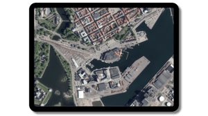
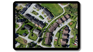
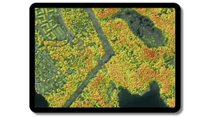
Geodata consists of web solutions and applications based on refined and packaged geodata from an extensive geodata warehouse. High-quality topographic maps are available as off-the-shelf products. Geodata customers primarily consist of public sector organizations, forest companies, energy sector companies, bank and insurance companies as well as industrial companies. An example use case is forest companies using Metria Maps to determine routes for forest harvesting machines, or energy companies planning grid constructions.
Property information
There are approximately 3.4 million properties in Sweden. Information about all of them is registered in the Property Register, where there is, among other things, information about property designation, addresses, property owner, purchase price, assessed value, area, coordinates, buildings, mortgages and easements.
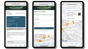
Our services give you access to updated, quality-assured information from the land registry - 24 hours a day, seven days a week. The delivery is flexible and can be adapted to the needs, working methods and systems you have in your organization.
Transform data into knowledge
Many industries are affected by conditions in nature. Where to build 5G masts most efficiently? Where should the forest be thinned? Which areas are threatened by rising water levels? How to secure the population of wild bees? From large amounts of geographic information, we extract what is needed or create what does not exist, analyze and compile it so that your organization can make smarter, greener and safer decisions.
Digital services
Visualizing, mapping and analyzing geodata systematically is a help to make more substantiated decisions and gain a deeper understanding of the business.
With systems and solutions that digitize, streamline and make valuable information available in the organization, the competitiveness required today and tomorrow is ensured.